Side Events
Exhibition
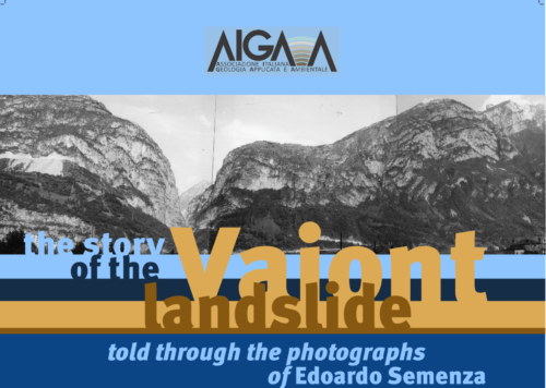
The knowledge of the Vajont landslide through the photos of Edoardo Semenza
November 15, 16 and 17
Palazzo degli Affari, Second Floor
Edited by Monica Ghirotti, Francesco M. Guadagno, Giovanni Masè, Michele Semenza, Paolo Semenza, Pietro Semenza and John J. Clague
The “Vajont disaster” of 9 October 1963, a paradigm of the catastrophe of human origin, is illustrated through the exceptional photos taken by Prof. Edoardo Semenza before and immediately after the event.
Edoardo Semenza was an engineering-geologist and one of Italian leading landslide researchers. He put his distinctive mark on the understanding of the Alpine range structure, making original contributions to the geology, tectonics and geomorphology of the Dolomites.
Semenza was the geologist who discovered that an ancient landslide mass was present on the southern side of the Vajont valley upstream from the reservoir under construction, years before the beginning of its initial mobilization.
In the images shown in the thirteen roll-ups, the intuitions, growing awareness, and sense of urgency of the man who first recognized the existence of the ancient landslide become evident. They reveal his “mente et malleo” approach, which allowed him to develop a model of the slope and what today we call risk scenarios.
His discovery was immediately taken into consideration by the designer and project managers of the dam, albeit only as a hypothesis to be verified with follow-up research and investigations. Unfortunately, his work, which lasted until 1961, did not prevent the disaster from taking place.
Semenza’s photographs therefore allow us to access both his intimate and personal, and professional dimensions.
The landslide is still today the subject of debate and scientific reflection, due to the extraordinary amount of data available, as well as to the corpus of memories, stories, and testimonies that affected communities preserve and continue to build. A part of these materials, taken from the volume and CD “The photos of the Vajont landslide” and from Edoardo Semenza’s book on the landslide, is shown in the roll-up banners, and constitutes a contribution to the discussion. Texts, images and captions are selected and adapted from these two publications.
Through this exhibition and a renewed attention to Semenza’s work we hope to raise awareness on the fundamental role that the knowledge of geology holds for the respect and protection of the environment.
This exhibition is organized by the Italian Association of Applied and Environmental Geology (AIGA-Associazione Italiana di Geologia Applicata e Ambientale) on the occasion of the 6th World Landslide Forum for the sixtieth anniversary of the Vajont disaster.
Multi-risk science for resilient communities under a changing climate - Ground instabilities: from back learning to forward scenarios in a multihazard resilience perspective
Wednesday, November 15
Palazzo degli Affari
Limonaia
08.30 – 13.00
Speakers: Salvatore Martino, Francesca Bozzano, Domenico Calcaterra, Diego Di Martire – Fondazione RETURN
The RETURN Project (multi-Risk sciEnce for resilienT commUnities undeR a changiNg climate project) includes research activities on ground instabilities. The objective is returning multihazard scenarios referred to ground instabilities that can be used to plan counter-measures to increase the resilience of urban areas, infrastructures and communities with a view to greater sustainability.
The RETURN project has a three-year duration and began on 1 December 2022. The RETURN activities have now reached the end of the first year which saw a wide selection of previous case studies on the national and international territory, managed to transfer contents learned in terms of know-how and rationales distinguished by process inducing ground instabilities (landslides, subsidence, sinkhole and liquefaction) and by kinematic category (slow or fast). These processes refer to subaerial and underwater environments as well as to different contexts, from mountain to near shore, passing through hilly sectors, plains and coastal areas. The effort to rationalize the learning cases has led to the identification and structuring of functional tools to return degrees of severity (with classes or indices) or intensity (through analytical or functional algorithms) of predisposing, preparatory and triggering factors for ground instabilities, considering the first as time-invariant (i.e., factors controlling the ground instability process ) while the second and third as time-dependent respect time windows of medium-long and long duration respectively (i.e., causative processes).
The event is a project workshop opened to the participants of the Return project registered to WLF6 and it is organized to communicate the ongoing results, opening a discussion within the assembly of researchers involved in the project on how to apply the tools identified to date to the reconstruction of scenarios, through the design of a Proof of Concept that expresses the operation in an integral form by type and category of process.
The workshop is open to all the WLF6 participants. A pre-registration is not required, but due to the limited capacity of the meeting room, participants can attend the workshop on a first come first served basis.
ADVANCING GEOHAZARD MONITORING: LEVERAGING SATELLITE RADAR DATA FROM WIDE AREA ANALYSIS TO TARGETED LOCAL STUDIES
Wednesday, November 15
Palazzo degli Affari
First Floor – Hall 1A
13.00 – 14.00
Speaker: Iolanda Iannicella – TRE ALTAMIRA
After a slow uptake, spaceborne radar interferometry is becoming a key tool for wide area ground deformation mapping and for monitoring programs. Wide Area Processing (WAP) has enabled users to gain synoptic insights into displacement phenomena across vast territories, exemplified by the achievements of the European Ground Motion Service. These results are paving the way for new environmental monitoring programs, providing information on a variety of natural and anthropogenic hazards. The expanding array of satellite data sources has opened up unprecedented opportunities for interferometric applications, prompting a shift from a static view of the Earth’s surface to a continuous stream of space-based ground motion measurements. While WAP primarily relies on medium-resolution Synthetic Aperture Radar (SAR) acquisitions, such as those from the ESA Sentinel-1 constellation or L-Band satellites, it serves as a valuable foundation for identifying unstable regions prone to events like landslides, sinkholes, and subsidence. High-resolution SAR imagery from satellites like COSMO-SKyMed, TerraSAR-X, and PAZ complements Sentinel-1 data, offering a more comprehensive understanding of geohazards. This workshop aims to showcase the potential of satellite interferometric data as potent tools for monitoring and risk management. Through a series of compelling case studies, we will demonstrate how these data can raise awareness among local and regional authorities about the critical need for proactive geohazard mitigation.
A box lunch will be offered to the participants. A pre-registration is required to attend this workshop.
This event is fully booked, registrations are now closed.
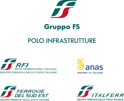
SUSTAINABLE AND RESILIENT RAIL AND ROAD INFRASTRUCTURES: LANDSLIDE MANAGEMENT AND CLIMATE ADAPTATION
When the infrastructural network generates connections
Wednesday, November 15
Palazzo degli Affari
Second Floor – Hall 2A
13.00 – 14.00
The Ferrovie dello Stato Group, through its Infrastructure Unit (Rete Ferroviaria Italiana, as lead company, Anas, Italferr and Ferrovie del Sud-Est), promotes studies on the territory, as well as research, design and implementation of measures to manage the wide-ranging interaction of landslide phenomena with transport infrastructures.
In a geologically fragile context such us the Italian one, the Ferrovie dello Stato Group takes the opportunity to share its know-how and experience, gained through the continuous management of thousands of kilometres of railways and roads.
The “Resilience Transformation Roadmap” will make infrastructure increasingly robust through:
1. defining climate adaptation guidelines with decision support tools;
2. strengthening sensor networks and developing of monitoring systems to cope with extreme events;
3. forecasting models for the occurrence of extreme events.
A journey that combines past experience with future action, with the protection of human life at its core.
A box lunch will be offered to the participants. A pre-registration is required to attend this workshop.
This event is fully booked, registrations are now closed.
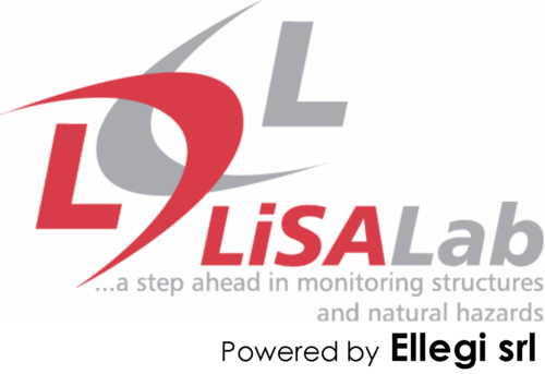
2003-2023 TWENTY YEARS OF GBINSAR NATURAL HAZARD AND LANDSLIDE MONITORING: WORLDWIDE EXAMPLES AND CASE STUDIES
Thursday, November 16
Palazzo degli Affari
Second Floor – Hall 2A
13.00 – 14.00
Speakers:
Teresa Nolesini – Università di Firenze
Lene Kristensen – Norwegian Water Resources and Energy Directorate
Luca dei Cas – Arpa Lombardia
The 2023 marks the twentieth anniversary of the operational use of GbInSAR LiSALAb technology in monitoring natural hazards.
This workshop aims to take a journey through these 20 years, during which experienced three users will describe their experiences in employing this technology for monitoring natural hazards, particularly landslides, even in emergency scenarios.
The first contribution will focus on monitoring natural hazards such as volcanoes or during emergencies. The second presentation will showcase the application of this technology in environmentally challenging conditions characterized by low temperatures and high latitudes such as in Nordic environments.
Finally, the third and last presentation will delve into the utilization of this tool within Alpine region.
A box lunch will be offered to the participants. A pre-registration is required to attend this workshop.
This event is fully booked, registrations are now closed.
INNOVATIVE MONITORING AND MODELLING FOR ROCK SLOPES’ STABILITY: THE CARRARA MARBLE QUARRIES
Thursday, November 16
Palazzo degli Affari
Third Floor – Hall 3A
13.00 – 14.00
Introduction by Claudio Margottini
Presentation of Carrara Ma.R.Mo. 2023 Network by Orlando Pandolfi
Greetings of Serena Arrighi, Mayor of Carrara
Speakers:
Claudio Oggeri & Alberto Cina – Politecnico of Turin
Pierpaolo Oreste – Politecnico of Turin
Domenico Gullì – USL Toscana Nord Ovest
Riccardo Salvini – University of Siena
Orlando Pandolfi & Nicola Santoro – Orlando Pandolfi Studio Carrara
Carrara marble quarries represent a model of world excellence for stone quarrying for many reasons: the concentration in a limited geographical area of quarries that have been nurtured for over two thousand years, the innovative technologies used in them and the significant scientific research conducted over the years by numerous research institutions.
In this workshop held in the framework of the 6th World Landslide Forum, some specific case histories applicable to marble and ornamental stone quarries’ rock walls are presented.
The workshop opens a series of technical-scientific events aimed at encouraging the exchange and sharing of knowledge and best practices in the nurturing of ornamental stone quarries.
The workshop is open to all the WLF6 participants. A pre-registration is not required, but due to the limited capacity of the meeting room, participants can attend the workshop on a first come first served basis.
LARAM Alumni event - From 2006, to today, towards the future
Thursday, November 16
Palazzo degli Affari
Fourth Floor – Hall 4
13.00 – 14.00
Speakers:
Settimio Ferlisi – LARAM School, President
Michele Calvello – LARAM School, Coordinator
Sabatino Cuomo – LARAM School, Coordinator
Dario Peduto – LARAM School, Chair Technical Committee
Past-students of LARAM School – from 2006
After attending the LARAM School organized by the University of Salerno (Italy), many lecturers and students of the different annual courses have been meeting, here and there, at various scientific events, including recurrent conferences such as the World Landslide Forums, the International Symposiums on Landslides and the assemblies of the European Geosciences Union. Of particular note is an event organised in 2012 by the University of Salerno in Ravello, Italy, in the form of a general meeting of lecturers and experts related to LARAM, to highlight possible future trends for teaching and research in landslide risk assessment, zoning and management.
At WLF6 in Florence, we decided to gather with (as many as possible) LARAM Alumni. To this aim, the LARAM School is organizing a lunchtime brainstorming session with former LARAM students who are still active in the field and, as such, are participating in this important scientific event. Many of you have achieved prestigious positions in academic institutes or other institutional settings after a few years from the participation in the LARAM course, and therefore face the problems and challenges of landslides on a daily basis.
It will be a rather short lunchtime meeting, but it will be hopefully long enough to launch some topics. A short initial presentation about who we are (who you are now, former LARAM-students), and a word cloud with some ideas will trigger the discussion. Then, we will say goodbye, confident that some of you may take part in the next editions of the LARAM courses as a lecturer, while with the others we will meet in research projects or conferences.
A box lunch will be offered to the participants. A pre-registration is required to attend this workshop.
This event is fully booked, registrations are now closed.
HEXAGON “TOTAL MONITORING”: USE CASES, NEW TOOLS AND CHALLENGES IN NATURAL HAZARD MONITORING
Friday, November 17
Palazzo degli Affari
Second Floor – Hall 2A
13.00 – 14.00
Speakers:
Matthias Twardzik – GEO Monitoring / IDS GeoRadar
Paolo Dallocchio – Leica Geosystems Italia
Susanne Wahlen – Geopraevent AG
Hexagon AB is the global leader in digital reality solutions, combining sensor, software and autonomous technologies. IDS GeoRadar, Geopraevent and Leica Geosystems represent Hexagon Geosystems’ core in terms of technologically advanced solutions, combining monitoring technologies to deliver real-time movement insights: a compound experience of several thousand monitoring projects in over one hundred countries.
During this talk, participants will have the opportunity to acknowledge the Total Monitoring, a concept of using a combination of different technologies to provide reliable information about movements in the monitored area and the most advanced technologies to enhance early-warning and situational awareness: Total Stations, GbInSAR, Radar Doppler, high-end deformation cameras and relevant software.
A box lunch will be offered to the participants. A pre-registration is required to attend this workshop.
This event is fully booked, registrations are now closed.
NEW TECHNOLOGIES FOR LANDSLIDE MONITORING AND MAPPING
Friday, November 17
Palazzo degli Affari
Basement – Hall -1
14.30 – 16.00
Speakers:
Luca Guerrieri – ISPRA
Giovanni Battista Crosta, Paolo Frattini – University of Milano Bicocca
Federico Raspini – OGS – University of Florence
Paolo Mazzanti, Gian Marco Marmoni – Sapienza University
Rita Tufano – University of Napoli Federico II
Chiara Martinello – University of Palermo
Settimio Ferlisi – University of Salerno
GeoSciences IR is a project funded by NextGenerationEU programme, with the goal of establishing a research infrastructure for the Italian Network of Regional Geological Surveys. The project involves the participation of 16 partners from academic and research institutions.
The GeoSciences IR event at WLF6 aims to present innovative landslide monitoring techniques, methods for landslide mapping and inventories updating, landslide risk analysis and mitigation measures under implementation in the project.
The workshop is open to all the WLF6 participants. A pre-registration is not required, but due to the limited capacity of the meeting room, participants can attend the workshop on a first come first served basis.

“LOOKING BEYOND” EXHIBITION
Saturday, November 18
Earth Technology Expo
Fortezza da Basso, Viale Filippo Strozzi 1, Florence
10.00 – 10.30
“Looking Beyond” is the satellite imagery exhibition promoted by the Italian Ministry of Foreign Affairs and International Cooperation together with the Italian Space Agency and Telespazio/e GEOS and curated by Filippo Maggia.
The exhibition provides an opportunity to reflect on the contribution of satellite technologies to Earth observation, the promotion of sustainable development and the protection of natural and cultural heritage.
The exhibition, made up of images of the COSMO SkyMed satellite constellation from the Telespazio/e GEOS database and the Italian Space Agency, is part of the initiatives promoted by the Ministry of Foreign Affairs and International Cooperation for the integrated promotion of Italy and Made in Italy, travelling around the world to more than 50 countries.
The project will be presented in both physical and digital format at Earth Technology Expo 2023 as part of the promotion of the International Astronautical Congress 2024 in Milan.
The exhibition will be divided into four themes/sections: Agriculture , Cities , Climate Change and Water. The selection of satellite images processed and distributed by e-GEOS – an ASI/Telespazio company and exclusive worldwide distributor of COSMO SKyMed radar data – covering the entire planet, combines the spectacular aspect of the images with their relevance as a study and analysis tool.
The event is hosted by Earth Technology Expo and is therefore free of charge, but participants should register at the following link to get the ticket:
https://etexpo.it/en/visit/visit earth technology expo
Here be landslides: Florence from Romans up to now
Join our researchers turned local guides in a breathtaking 3-hours walk through striking monuments, anecdotes and spots of Florence. Following the historical footsteps of Leonardo Da Vinci and the powerful Medici family, a non-technical and interactive tour will show the deep interconnections between the local geology and the history of Florence, from its foundation to present time, highlighting some of the most remarkable monuments and palaces built since medieval time: their very stones can tell a fascinating story, often forgotten by the Florentine people, and show hidden scars of ancient and recent hazardous events like floods and landslides.